Burnaby 5kmLast updated February 9, 2026 at 8:04 AM
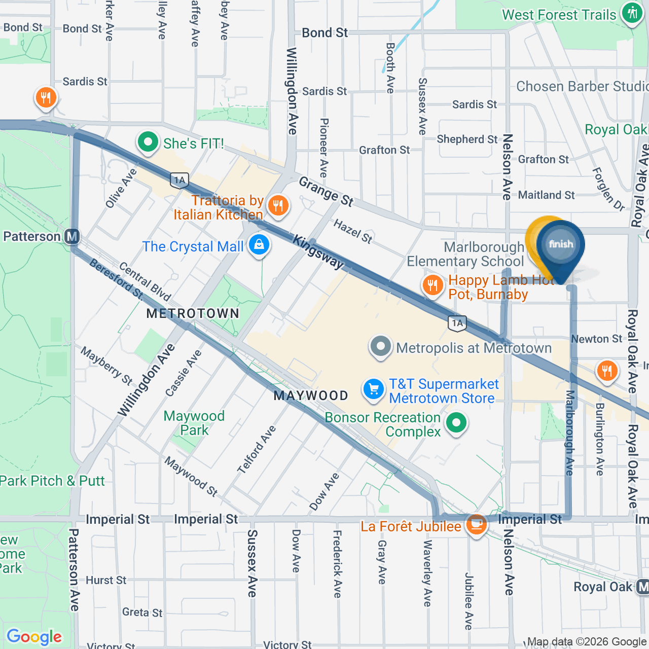
1. WEST through Marlborough School parking lot to Nelson Ave
2. SOUTH on Nelson Avenue (East sidewalk)
3. Cross Nelson Avenue at Sanders Street (South crosswalk)
4. SOUTH on Nelson Avenue (West sidewalk)
5. WEST on Kingsway until Mckay. (stay on the north sidewalk the entire route).
6. Visit BC Housing Rest Stop at McKay Avenue and Kingsway (WEST side of McKay).
7. WEST on Kingsway (north sidewalk)
8. SOUTH on Wilson Avenue
9. WEST on Kingsway (South sidewalk)
10. SOUTH on Patterson (east sidewalk)
11. Cross Central Blvd to BC Parkway path under Patterson Skytrain.
12. EAST on BC Parkway under the skytrain (newly lit up path)
13. SOUTH off BC Parkway path at McKay Ave (cross Beresford to South side)
14. EAST on Beresford past Burnaby Neighbourhood house (South sidewalk)
15. NORTH at crosswalk on Telford/Beresford back to BC Parkway Path under skytrain
16. EAST on BC Parkway path under skytrain.
17. Continue along BC Parkwaypath until the path ends at Central Blvd.
18. SOUTH on Central Blvd.
19. EAST on Imperial (north sidewalk)
20. NORTH on Marlborough Avenue (west sidewalk)
21. At the firehall enter through south doors off Marlborough Avenue
22. Exit firehall through north doors on Bennett
23. EAST on Bennett (south sidewalk)
24. NORTH on Marlborough Avenue (west sidewalk)
25. Cross Sanders to Marlborough school courtyard. Enter through the front doors of the school.